

Satellites Track Urban Climate Change. Researchers Develop Tool for Cities and the Public
30. April 2026What is the state of urban greenery? And is it deteriorating as a result of climate change? Researchers from Tomas Bata University (TBU) in Zlín, in collaboration with the Slovak University of Technology in Bratislava – specifically its Faculty of Materials Science and Technology based in Trnava – are introducing an innovative solution. As part of the SatKlima project, they are using European satellite data to monitor the condition of vegetation in urban areas. The outcome will be a freely accessible online platform enabling municipalities, cities and the wider public to track the impacts of climate change directly within their own regions.
The project, titled “SatKlima: Satellite Monitoring of Regions as Support for Public Administration in Climate Change Adaptation Strategies”, responds to the increasingly evident impacts of climate change at the local level. These are manifested primarily through drought, loss of greenery and the overall degradation of vegetation. Cities and municipalities are on the front line – developing adaptation strategies, planning planting schemes and protecting vulnerable areas. However, they have often lacked easily accessible and comprehensible data to inform their decision-making.
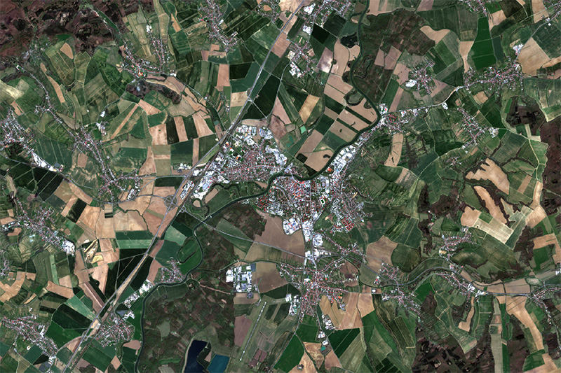
The research team works with imagery from Sentinel-2 satellites within the European Copernicus programme, implemented by the European Space Agency in cooperation with the European Commission. These data are publicly available and free of charge. “The acquired imagery enables the calculation of the so-called NDVI index – a simple indicator of vegetation health. By monitoring its development over time, it is possible to identify precisely where greenery is deteriorating, where critical drought conditions are emerging, and where public authorities need to intervene,” explains Jakub Trojan from the Faculty of Logistics and Crisis Management at TBU, a co-investigator on the project.
“The project’s main output will be a user-friendly online tool. Users will simply select a specific location on a map and immediately obtain an overview of vegetation trends over recent years. The system is designed to require no technical expertise,” says Petra Svěráková, spokesperson for the university. In its pilot phase, data are already available for selected cities in the Zlín Region, such as Zlín, Uherské Hradiště and Vsetín, as well as regional capitals in western Slovakia, including Trnava, Žilina and Trenčín. The project will also include a model adaptation strategy with a concrete action plan for a selected area of the Zlín Region.
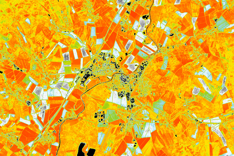
“Our aim is to make complex satellite data accessible and usable for everyday public administration. We want to provide mayors and the public with a tool that helps them better understand what is happening to their environment and enables them to respond to these changes in a timely manner,” adds Jakub Trojan.
“In this way, the SatKlima project represents a significant step towards more effective management of climate change impacts at the local level, through the use of modern technologies, open data and interdisciplinary collaboration,” concludes Zuzana Tučková, Dean of the Faculty.